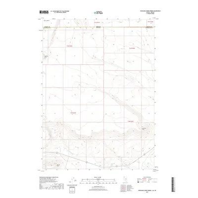
2018 Map of Thousand Creek Spring
USGS Topo · Published 2018About this map
Thousand Creek Spring sits at the heart of this high-desert landscape in northern Humboldt County, where water sources dictate the geography of the Great Basin. This 2018 survey documents a remote corner of the Nevada and Oregon borderlands, specifically where the state line meets the boundary between Humboldt and Harney counties. The drainage network is defined by Big Spring Cr and Thousand Cr, which cut through a terrain of prominent volcanic features. Significant landmarks like the elevated Big Spring Table and the distinctively named Hawksy Walksy area demonstrate the area's geological character. For researchers of the American West, the map provides precise locations for isolated landmarks such as Boundary Butte and Flat Top Butte, which have served as navigational waypoints in this arid region for generations.
Find a feature on this map
15 named features on this map. Tap any name to fly to it.
Don’t see what you’re looking for? This feature index may not catch every label — zoom into the map to look around manually.
Map Details
Editions of this 2018 Thousand Creek Spring Map
This is the sole edition of this map. No revisions or reprints were ever made.
Other maps of this area

1886 · Disaster
USGS Topo · 1:250,000

1889 · Long Valley
USGS Topo · 1:250,000

1893 · Disaster
USGS Topo · 1:250,000

1954 · Vya
USGS Topo · 1:250,000

1955 · Adel
USGS Topo · 1:250,000

1957 · Adel
USGS Topo · 1:250,000

1958 · Vya
USGS Topo · 1:250,000

1958 · Adel
USGS Topo · 1:250,000

1962 · Vya
USGS Topo · 1:250,000

1962 · Adel
USGS Topo · 1:250,000