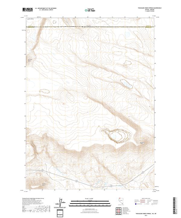
2021 Map of Thousand Creek Spring
USGS Topo · Published 2021About this map
The Oregon Nevada state line cuts through this high desert region of Humboldt Co, where the landscape is defined by drainage basins and volcanic plateaus. The southern reach of the Harney Co boundary meets the state line near the northern edge of the map, marking a point where interstate surveying and regional water management converge. The terrain is characterized by broad tables and distinct basaltic rises, including the prominent landforms of Big Spring Table and the uniquely named Hawksy Walksy heights in the northwest.
Find a feature on this map
14 named features on this map. Tap any name to fly to it.
Don’t see what you’re looking for? This feature index may not catch every label — zoom into the map to look around manually.
Map Details
Editions of this 2021 Thousand Creek Spring Map
This is the sole edition of this map. No revisions or reprints were ever made.
Other maps of this area

1886 · Disaster
USGS Topo · 1:250,000

1889 · Long Valley
USGS Topo · 1:250,000

1893 · Disaster
USGS Topo · 1:250,000

1954 · Vya
USGS Topo · 1:250,000

1955 · Adel
USGS Topo · 1:250,000

1957 · Adel
USGS Topo · 1:250,000

1958 · Vya
USGS Topo · 1:250,000

1958 · Adel
USGS Topo · 1:250,000

1962 · Vya
USGS Topo · 1:250,000

1962 · Adel
USGS Topo · 1:250,000