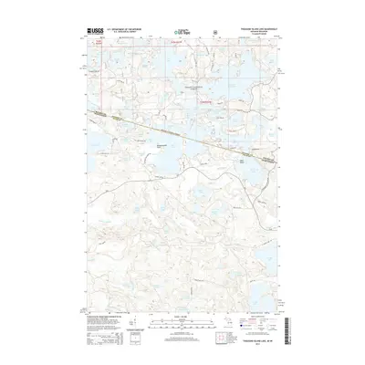
2014 Map of Thousand Island Lake
USGS Topo · Published 2014About this map
Ottawa National Forest dominates this landscape, where the border between Gogebic Co, Michigan, and Vilas Co, Wisconsin, cuts directly through a dense network of glacial lakes. The intricate shoreline of Thousand Island Lake is the centerpiece, featuring numerous named points and islands such as Indian Point, Meadowwoods Point, and Belle Island. This area serves as a significant drainage basin, with water bodies like Cisco Lake, Lindsley Lake, and Fishhawk Lake connected by small channels and streams. The local road network, including Thousand Island Lake Rd and S Cisco Lake Rd, provides access to private lakefront parcels and public forest lands. The map illustrates a late 20th and early 21st-century pattern of recreational development and forestry management, characterized by numerous small lakes like Jane Lake, Morley Lake, and Crampton Lake that define the regional geography.
Find a feature on this map
93 named features on this map. Tap any name to fly to it.
Don’t see what you’re looking for? This feature index may not catch every label — zoom into the map to look around manually.
Map Details
Editions of this 2014 Thousand Island Lake Map
This is the sole edition of this map. No revisions or reprints were ever made.
Other maps of this area

1939 · Trout Lake
USGS Topo · 1:48,000

1946 · Star Lake
USGS Topo · 1:48,000

1946 · Trout Lake
USGS Topo · 1:48,000

1949 · Trout Lake
USGS Topo · 1:48,000

1950 · Star Lake
USGS Topo · 1:48,000

1952 · Thayer
USGS Topo · 1:62,500

1955 · Marenisco
USGS Topo · 1:62,500

1955 · Starlake
USGS Topo · 1:62,500

1955 · Boulder Junction
USGS Topo · 1:62,500

1958 · Iron River
USGS Topo · 1:250,000