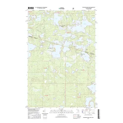
2017 Map of Thousand Island Lake
USGS Topo · Published 2017About this map
Ottawa National Forest blankets this borderland where the Michigan Upper Peninsula meets Wisconsin, creating a dense network of glacial lakes and intricate shorelines. The landscape is dominated by the Thousand Island Lake system, featuring numerous points and islands such as Belle Island and the prominent Indian Point. This 2017 survey details a region defined by water-access settlements and recreational geography, including Meadowwoods Point and various landings. The intricate connectivity between Cisco Lake, Lindsley Lake, and Fishhawk Lake illustrates the complex drainage patterns of the high Northwoods. Local transit is limited to winding forest roads like S Cisco Lake Rd and Thousand Island Lake Rd, which serve the small lakeside communities and remote camps scattered across Gogebic Co and Vilas Co.
Find a feature on this map
97 named features on this map. Tap any name to fly to it.
Don’t see what you’re looking for? This feature index may not catch every label — zoom into the map to look around manually.
Map Details
Editions of this 2017 Thousand Island Lake Map
This is the sole edition of this map. No revisions or reprints were ever made.
Other maps of this area

1939 · Trout Lake
USGS Topo · 1:48,000

1946 · Star Lake
USGS Topo · 1:48,000

1946 · Trout Lake
USGS Topo · 1:48,000

1949 · Trout Lake
USGS Topo · 1:48,000

1950 · Star Lake
USGS Topo · 1:48,000

1952 · Thayer
USGS Topo · 1:62,500

1955 · Marenisco
USGS Topo · 1:62,500

1955 · Starlake
USGS Topo · 1:62,500

1955 · Boulder Junction
USGS Topo · 1:62,500

1958 · Iron River
USGS Topo · 1:250,000