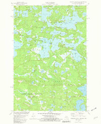
1981 Map of Thousand Island Lake
USGS Topo · Published 1982About this map
The Ottawa National Forest and Northern Highland-American Legion State Forest meet at the boundary of Michigan and Wisconsin in this early 1980s topographic record. The landscape is defined by an intricate glacial lake system, centered on the sprawling reaches of Thousand Island Lake. The map reveals a transition between the deep woods of Gogebic County and Vilas County, where the irregular shorelines of Cisco Lake, Lindsley Lake, and Fishhawk Lake create a complex geography of peninsulas and narrows. Notable landmarks include Meadowwoods Point and Indian Point, while the presence of a Gravel Pit and scattered boat ramps suggests the quiet intersection of local resource extraction and growing recreational use. The detailed hydrography, including smaller bodies like Little Mosquito Lake and Grace Lake, illustrates the interconnected water network of the Northwoods.
Find a feature on this map
70 named features on this map. Tap any name to fly to it.
Don’t see what you’re looking for? This feature index may not catch every label — zoom into the map to look around manually.
Map Details
Editions of this 1981 Thousand Island Lake Map
2 editions found
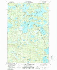
Other maps of this area

1939 · Trout Lake
USGS Topo · 1:48,000

1946 · Star Lake
USGS Topo · 1:48,000

1946 · Trout Lake
USGS Topo · 1:48,000

1949 · Trout Lake
USGS Topo · 1:48,000

1950 · Star Lake
USGS Topo · 1:48,000

1952 · Thayer
USGS Topo · 1:62,500

1955 · Marenisco
USGS Topo · 1:62,500

1955 · Starlake
USGS Topo · 1:62,500

1955 · Boulder Junction
USGS Topo · 1:62,500

1958 · Iron River
USGS Topo · 1:250,000