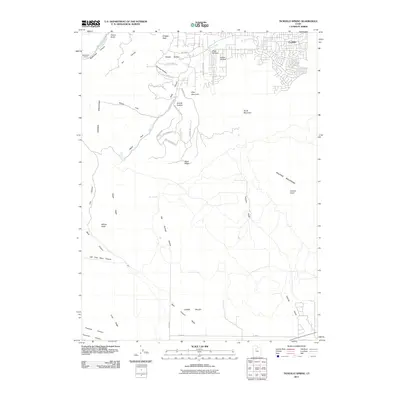
2011 Map of Tickville Spring
USGS Topo · Published 2011About this map
The Oquirrh Mountains and Traverse Mountains meet in this 2011 survey, showing a landscape defined by dramatic ridgelines and the expansion of modern residential corridors. The northern portion of the map highlights the development of Foothills, where streets like Majestic Oaks Ln and Sharose Rd push into the foothills of the high desert. Historical infrastructure remains visible, most notably the Butterfield Tunnel near Butterfield Creek in the northwest corner, a remnant of the region's deep-rooted mining and engineering legacy. Drainage patterns are well-documented, from the intermittent flow of Tickville Gulch to the perennial source at Tickville Spring. The map captures the interface between the high peaks of Shaggy Peak and the emerging suburbs of Eagle Mountain, documenting a period of significant geographical transition.
Find a feature on this map
48 named features on this map. Tap any name to fly to it.
Don’t see what you’re looking for? This feature index may not catch every label — zoom into the map to look around manually.
Map Details
Editions of this 2011 Tickville Spring Map
This is the sole edition of this map. No revisions or reprints were ever made.
Other maps of this area

1885 · Salt Lake
USGS Topo · 1:250,000

1885 · Tooele Valley
USGS Topo · 1:250,000

1915 · Fairfield
USGS Topo · 1:62,500

1917 · Fairfield
USGS Topo · 1:62,500

1925 · Ft. Douglas
USGS Topo · 1:125,000

1928 · Ft. Douglas
USGS Topo · 1:125,000

1951 · Jordan Narrows
USGS Topo · 1:24,000
1951 · Saratoga Springs
USGS Topo · 1:24,000

1951 · Midvale
USGS Topo · 1:24,000

1952 · Bingham Canyon
USGS Topo · 1:24,000