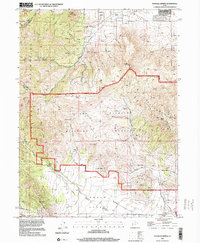
1997 Map of Tickville Spring
USGS Topo · Published 2001About this map
Camp Williams Military Reservation dominates the central and eastern portions of this late-twentieth-century landscape, marked by numerous Target Ranges and extensive 4WD access routes. The map illustrates a rugged transition between the Oquirrh Mountains to the northwest and the Traverse Mountains to the east. Local geography is defined by prominent peaks like Shaggy Peak and Step Mtn, as well as numerous drainage systems including Yellow Fork Canyon and Rose Canyon.
Find a feature on this map
46 named features on this map. Tap any name to fly to it.
Don’t see what you’re looking for? This feature index may not catch every label — zoom into the map to look around manually.
Map Details
Editions of this 1997 Tickville Spring Map
This is the sole edition of this map. No revisions or reprints were ever made.
Other maps of this area

1885 · Salt Lake
USGS Topo · 1:250,000

1885 · Tooele Valley
USGS Topo · 1:250,000

1915 · Fairfield
USGS Topo · 1:62,500

1917 · Fairfield
USGS Topo · 1:62,500

1925 · Ft. Douglas
USGS Topo · 1:125,000

1928 · Ft. Douglas
USGS Topo · 1:125,000

1951 · Jordan Narrows
USGS Topo · 1:24,000
1951 · Saratoga Springs
USGS Topo · 1:24,000

1951 · Midvale
USGS Topo · 1:24,000

1952 · Bingham Canyon
USGS Topo · 1:24,000