2023 Map of Tipton
USGS Topo · Published 2023About this map
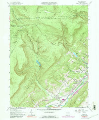
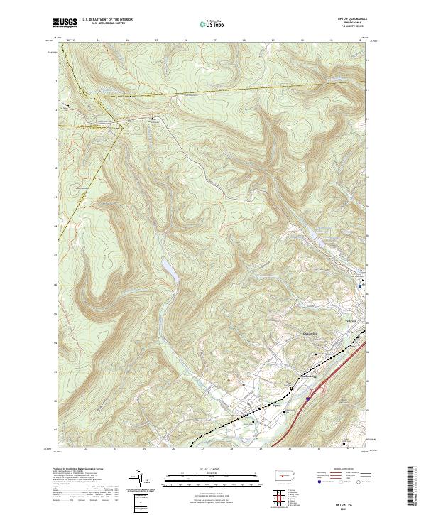
The Little Juniata River valley anchors this study of the Pennsylvania landscape, where the settlements of Tipton, Charlottsville, and Grazierville follow the lowland corridor. This area is a complex intersection of four counties—Blair, Centre, Cambria, and Clearfield—where the terrain shifts from the heights of Lost Mountain to the deep hollows of Fry Hollow and Mulligan Hollow. Family history and local genealogy are well-represented by several small burial sites, including the Fox Family Cem, Jacker Burial Ground, and Cryder Family Cem. The industrial and municipal infrastructure of Tyrone is evident in the eastern portion of the map, particularly through the Tyrone Reservoir Number One and Tyrone Reservoir Number Two. Waterways like Tipton Run and Sink Run carve through the ridges, illustrating the drainage patterns that shaped the placement of early mountain roads like the Janesville Pike.
Find a feature on this map
68 named features on this map. Tap any name to fly to it.
Don’t see what you’re looking for? This feature index may not catch every label — zoom into the map to look around manually.
Map Details
Editions of this 2023 Tipton Map
This is the sole edition of this map. No revisions or reprints were ever made.