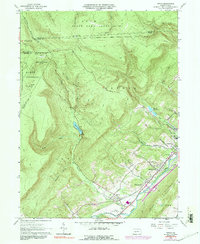
1963 Map of Tipton
USGS Topo · Published 1991About this map
Penn Central rail lines and the winding course of the Little Juniata River anchor this mid-century topographic record of northern Blair County. The settlement of Tipton serves as a focal point, situated near the Peterson Memorial Airfield and the recreation grounds of Bland Park. The landscape transitions sharply from the industrial and transit corridor in the valley to the protected highlands of Rush State Game Lands No 60 and State Game Lands No 158. Utility and infrastructure development is evident through the presence of the Tipton Reservoir, Tyrone Reservoirs, and a prominent pipeline traversing the northern ridges. Local genealogists will find several family-named landmarks and burial sites including Fox Cem, Oak Grove Cem, and Charlottsville Cem, alongside a Covered Bridge near Charlottsville.
Find a feature on this map
50 named features on this map. Tap any name to fly to it.
Don’t see what you’re looking for? This feature index may not catch every label — zoom into the map to look around manually.
Map Details
Editions of this 1963 Tipton Map
Other maps of this area

1903 · Houtzdale
USGS Topo · 1:62,500

1905 · Houtzdale
USGS Topo · 1:62,500

1920 · Altoona
USGS Topo · 1:62,500

1922 · Philipsburg
USGS Topo · 1:62,500

1922 · Altoona
USGS Topo · 1:62,500

1923 · Tyrone
USGS Topo · 1:62,500

1929 · Tyrone
USGS Topo · 1:48,000

1933 · Tyrone
USGS Topo · 1:62,500

1939 · Philipsburg
USGS Topo · 1:62,500

1944 · Houtzdale
USGS Topo · 1:24,000