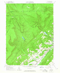
1963 Map of Tipton
USGS Topo · Published 1965About this map
The Little Juniata River corridor serves as the industrial and transit heart of this region in the mid-1960s, where the Pennsylvania railroad and multiple settlements align along the valley floor. Tyrone occupies the eastern edge of the sheet, while the smaller villages of Grazierville, Tipton, and Charlottesville follow the river's bend to the southwest. This era of the landscape is marked by a mix of local recreation and infrastructure, featuring Bland Park and the Peterson Memorial Airfield alongside industrial elements like a Substation and a Gaging Station near the river.
Find a feature on this map
50 named features on this map. Tap any name to fly to it.
Don’t see what you’re looking for? This feature index may not catch every label — zoom into the map to look around manually.
Map Details
Editions of this 1963 Tipton Map
Other maps of this area

1903 · Houtzdale
USGS Topo · 1:62,500

1905 · Houtzdale
USGS Topo · 1:62,500

1920 · Altoona
USGS Topo · 1:62,500

1922 · Philipsburg
USGS Topo · 1:62,500

1922 · Altoona
USGS Topo · 1:62,500

1923 · Tyrone
USGS Topo · 1:62,500

1929 · Tyrone
USGS Topo · 1:48,000

1933 · Tyrone
USGS Topo · 1:62,500

1939 · Philipsburg
USGS Topo · 1:62,500

1944 · Houtzdale
USGS Topo · 1:24,000