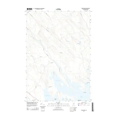
2014 Map of Tomah Ridge
USGS Topo · Published 2014About this map
Tomah Ridge and its surrounding watercourses define this portion of Washington County, where the landscape is a complex network of streams and expansive flowages. The drainage of Tomah Stream and Kennebec Brook feeds into the broad, island-dotted waters of Grand Falls Flowage and George Brook Flowage. This 2014 survey captures the area's transition from higher timberlands to the low-lying wetlands and points like Scow Point and Birch Point. Human presence is represented by long-established sites such as Lamb Place and a network of logging and access roads including Tomah Stream Rd and Belmore Point Rd. The map provides a detailed view of the watery margins of Black Cat Island and the isolated Enoch Lake, illustrating the sophisticated water management and natural geography of the Maine interior.
Find a feature on this map
28 named features on this map. Tap any name to fly to it.
Don’t see what you’re looking for? This feature index may not catch every label — zoom into the map to look around manually.
Map Details
Editions of this 2014 Tomah Ridge Map
This is the sole edition of this map. No revisions or reprints were ever made.
Other maps of this area

1929 · Calais
USGS Topo · 1:48,000

1932 · Calais
USGS Topo · 1:62,500

1940 · Waite
USGS Topo · 1:62,500

1940 · Kellyland
USGS Topo · 1:62,500

1941 · Big Lake
USGS Topo · 1:62,500

1942 · Kellyland
USGS Topo · 1:62,500

1942 · Waite
USGS Topo · 1:62,500

1943 · Big Lake
USGS Topo · 1:62,500

1952 · Big Lake
USGS Topo · 1:50,000

1957 · Fredericton
USGS Topo · 1:250,000