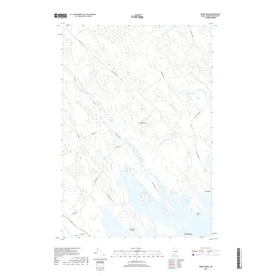
2018 Map of Tomah Ridge
USGS Topo · Published 2018About this map
Tomah Stream and Kennebec Brook dominate this interior Washington County landscape, carving through a network of wetlands and ridges as they flow toward the expansive water at the bottom of the quadrangle. The map captures a primarily undeveloped wilderness defined by its topography and a few legacy roads, such as Spednic Falls Rd and Enoch Brook Rd, which cut through the timberland. Near the southern shore, Lamb Place stands as a named location amongst the points and islands of the shoreline, including Black Cat Island, Scow Point, and Birch Point. The network of functional thoroughfares like Telephone Rd and Grand Lake Stream Rd suggests a landscape managed for resource access and local transit between the remote water bodies and rising terrain of Tomah Ridge.
Find a feature on this map
22 named features on this map. Tap any name to fly to it.
Don’t see what you’re looking for? This feature index may not catch every label — zoom into the map to look around manually.
Map Details
Editions of this 2018 Tomah Ridge Map
This is the sole edition of this map. No revisions or reprints were ever made.
Other maps of this area

1929 · Calais
USGS Topo · 1:48,000

1932 · Calais
USGS Topo · 1:62,500

1940 · Waite
USGS Topo · 1:62,500

1940 · Kellyland
USGS Topo · 1:62,500

1941 · Big Lake
USGS Topo · 1:62,500

1942 · Kellyland
USGS Topo · 1:62,500

1942 · Waite
USGS Topo · 1:62,500

1943 · Big Lake
USGS Topo · 1:62,500

1952 · Big Lake
USGS Topo · 1:50,000

1957 · Fredericton
USGS Topo · 1:250,000