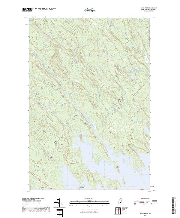
2024 Map of Tomah Ridge
USGS Topo · Published 2024About this map
Tomah Ridge and the winding course of Tomah Stream define this Washington County landscape, which transitions from upland ridges to the sprawling northern waters of Big Lake. The map reveals a network of interior timber and access roads, including Tomah Stream Rd, Telephone Rd, and Enoch Brook Rd, which pierce the dense forests to connect remote points.
Find a feature on this map
24 named features on this map. Tap any name to fly to it.
Don’t see what you’re looking for? This feature index may not catch every label — zoom into the map to look around manually.
Map Details
Editions of this 2024 Tomah Ridge Map
This is the sole edition of this map. No revisions or reprints were ever made.
Other maps of this area

1929 · Calais
USGS Topo · 1:48,000

1932 · Calais
USGS Topo · 1:62,500

1940 · Waite
USGS Topo · 1:62,500

1940 · Kellyland
USGS Topo · 1:62,500

1941 · Big Lake
USGS Topo · 1:62,500

1942 · Kellyland
USGS Topo · 1:62,500

1942 · Waite
USGS Topo · 1:62,500

1943 · Big Lake
USGS Topo · 1:62,500

1952 · Big Lake
USGS Topo · 1:50,000

1957 · Fredericton
USGS Topo · 1:250,000