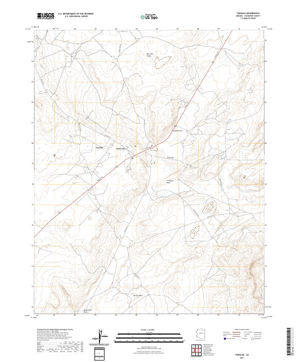
2021 Map of Tonalea
USGS Topo · Published 2021About this map
Tonalea serves as a focal point for this high-desert landscape in the early 2020s, situated near the seasonal waters of Red Lake. The terrain is characterized by a network of significant drainage features, including the southward-reaching Porcupine Wash and Narrow Wash, alongside the prominent Elephant Feet geological formations. This area of Coconino County is defined by its infrastructure of indigenous routes, where the historic Navajo Trl intersects with modern tribal roads like Indian Rte 21 and Indian Rte 6261. The mapping reveals a sparse but vital settlement pattern centered around the Red Lake Valley, illustrating how the hydrology of Begashibito Wash dictates the placement of roads and homesteads across the varied elevations of the Colorado Plateau.
Find a feature on this map
22 named features on this map. Tap any name to fly to it.
Don’t see what you’re looking for? This feature index may not catch every label — zoom into the map to look around manually.
Map Details
Editions of this 2021 Tonalea Map
This is the sole edition of this map. No revisions or reprints were ever made.