2024 Map of Tower Hill
USGS Topo · Published 2024About this map
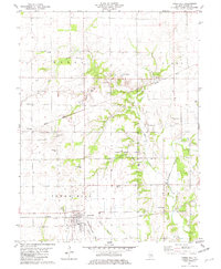
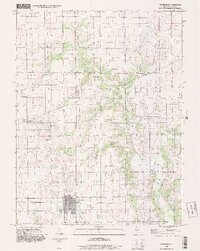
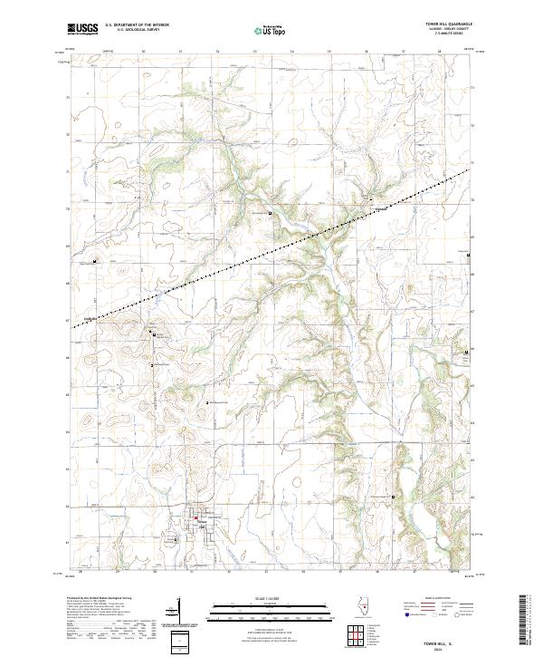
Tower Hill serves as the primary hub in this portion of Shelby County, situated where a network of local roads and sections meet in a landscape defined by agricultural grids and creek drainages. The topography is shaped by the winding course of Mud Creek and Robinson Creek, which cut through the level terrain to create localized relief. Genealogists will find a high density of burial sites across the township, from the Tower Hill Cem at the southern edge of town to smaller, family-named or denominational plots like Armstrong Cem, Knobs Baptist Cem, and Middlesworth Cem. Smaller settlements such as Henton and Dollville anchor the northern and western sections, respectively. The map details the transition between open farm fields and the wooded breaks along water bodies like Mitchell Creek and Angel Branch, illustrating the rural character of this Illinois prairie region.
Find a feature on this map
70 named features on this map. Tap any name to fly to it.
Don’t see what you’re looking for? This feature index may not catch every label — zoom into the map to look around manually.
Map Details
Editions of this 2024 Tower Hill Map
This is the sole edition of this map. No revisions or reprints were ever made.
Historical Maps of Tower Hill Through Time
3 maps found