2024 Map of Toxey
USGS Topo · Published 2024About this map
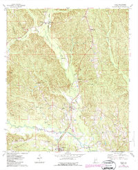
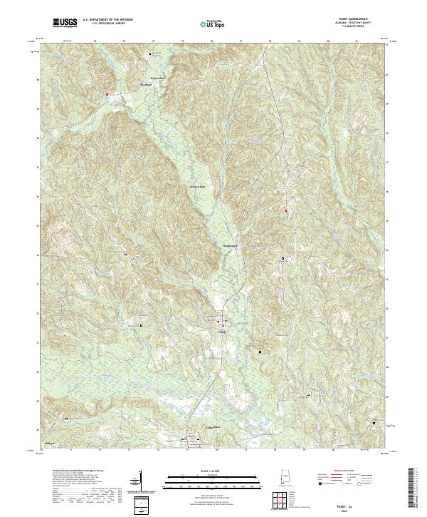
Toxey and Gilbertown anchor the central corridor of this west Alabama landscape, where the meandering course of Okatuppa Creek and its many tributaries define the local geography. The settlement pattern follows a clear north-south axis, connecting smaller locales like Needham, Hodgewood, and the junction at Jackson Spur. This region in Choctaw County is characterized by a dense network of country roads such as Chappell Hill Rd and Old Toxey Rd, which link numerous family and community landmarks. Genealogists will find significant value in the distribution of burial grounds across the townships, including Gilbertown Cem, Bonner Memorial Cem, and the Bogue Loosa Valley Cem to the north. The presence of features like Little Mill Creek and James Creek suggests a landscape shaped by small-scale waterpower and traditional timber or agricultural drainage systems typical of the deep south coastal plain.
Find a feature on this map
81 named features on this map. Tap any name to fly to it.
Don’t see what you’re looking for? This feature index may not catch every label — zoom into the map to look around manually.
Map Details
Editions of this 2024 Toxey Map
This is the sole edition of this map. No revisions or reprints were ever made.