2022 Map of Traer
USGS Topo · Published 2022About this map
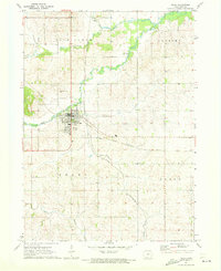
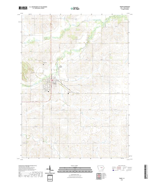
Wolf Creek and Twelvemile Creek define the agricultural landscape of this Tama County region, where the town of Traer serves as a central hub for the surrounding township sections. The town's grid is detailed with streets such as Main St and Toledo St, reflecting a well-established rural community layout. The periphery is marked by several historical burial grounds, including Buckingham Cem to the north and Saint Pauls Catholic Cem just south of the main settlement, providing valuable locations for genealogical research. The presence of the Traer Municipal Airport east of the town center highlights the area's modern infrastructure within a predominantly riparian environment shaped by Little Coon Creek and Simpson Creek. The land is divided into systematic townships such as t86n r14w and t85n r14w, illustrating the enduring impact of the Public Land Survey System on Iowa's geography.
Find a feature on this map
55 named features on this map. Tap any name to fly to it.
Don’t see what you’re looking for? This feature index may not catch every label — zoom into the map to look around manually.
Map Details
Editions of this 2022 Traer Map
This is the sole edition of this map. No revisions or reprints were ever made.