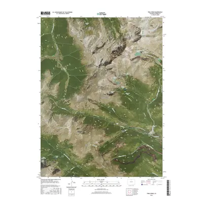
2016 Map of Trail Ridge
USGS Topo · Published 2016About this map
Louis R Levings Grave stands as a solitary human landmark amidst the high-altitude wilderness of Rocky Mountain National Park. This 2016 survey highlights the dramatic transition from the lush meadows of Horseshoe Park to the perennial ice of Rowe Glacier. The landscape is defined by the peaks of the Mummy Range, including Hagues Peak and Ypsilon Mtn, which tower over glacial lakes such as Crystal Lake and Ypsilon Lake.
Find a feature on this map
67 named features on this map. Tap any name to fly to it.
Don’t see what you’re looking for? This feature index may not catch every label — zoom into the map to look around manually.
Map Details
Editions of this 2016 Trail Ridge Map
This is the sole edition of this map. No revisions or reprints were ever made.
Other maps of this area

1915 · Longs Peak
USGS Topo · 1:125,000

1916 · Home
USGS Topo · 1:125,000

1919 · Rocky Mountain National Park
USGS Topo · 1:125,000

1920 · Home
USGS Topo · 1:125,000

1954 · Greeley
USGS Topo · 1:250,000

1957 · Greeley
USGS Topo · 1:250,000

1957 · Mc Henrys Peak
USGS Topo · 1:24,000

1957 · Trail Ridge
USGS Topo · 1:24,000

1957 · Longs Peak
USGS Topo · 1:24,000

1957 · Estes Park
USGS Topo · 1:24,000