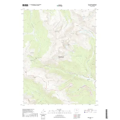
2019 Map of Trail Ridge
USGS Topo · Published 2019About this map
Louis R Levings Grave marks a singular human point in the high-elevation wilderness of the Mummy Range, where the landscape is defined by massive peaks and glacial remnants. High above the tree line, the Rowe Glacier sits beneath Hagues Peak and Rowe Peak, feeding a network of headwaters that includes the Cache La Poudre Wild and Scenic River and the Big Thompson River. The transition from glacial basins to forested valleys is clear at Horseshoe Park and Willow Park, while the Old Fall River Rd and the modern Trail Ridge road traverse the heights through Iceberg Pass and Rock Cut. A dense network of paths like the Ute Trail E and The Saddle Trail provide access to remote basins such as Hidden Valley and Hanging Valley, illustrating the long-established routes through this section of Rocky Mountain National Park.
Find a feature on this map
73 named features on this map. Tap any name to fly to it.
Don’t see what you’re looking for? This feature index may not catch every label — zoom into the map to look around manually.
Map Details
Editions of this 2019 Trail Ridge Map
This is the sole edition of this map. No revisions or reprints were ever made.
Other maps of this area

1915 · Longs Peak
USGS Topo · 1:125,000

1916 · Home
USGS Topo · 1:125,000

1919 · Rocky Mountain National Park
USGS Topo · 1:125,000

1920 · Home
USGS Topo · 1:125,000

1954 · Greeley
USGS Topo · 1:250,000

1957 · Greeley
USGS Topo · 1:250,000

1957 · Mc Henrys Peak
USGS Topo · 1:24,000

1957 · Trail Ridge
USGS Topo · 1:24,000

1957 · Longs Peak
USGS Topo · 1:24,000

1957 · Estes Park
USGS Topo · 1:24,000