2021 Map of Treloar
USGS Topo · Published 2021About this map
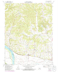
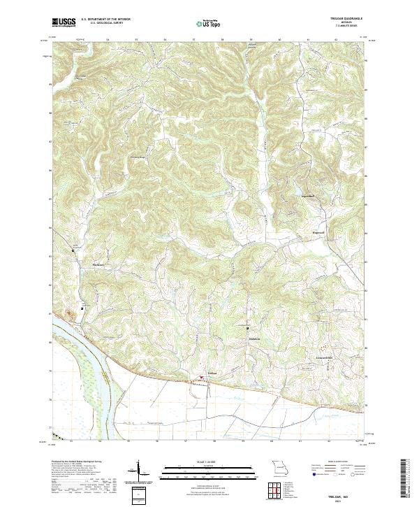
The Missouri River defines the southern boundary of this landscape, separating Warren Co from Franklin Co along a fertile floodplain characterized by Peers Slough and Duncan Lake. Just north of the river flats, the settlement of Treloar serves as a focal point for the surrounding rural uplands, where the terrain rises into prominent features like Pinckney Ridge and Buckeye Ridge. The distribution of historical burial sites, including Saint Johns Cem, Immanuels Cem, and Smith Creek Cem, provides essential points of reference for genealogists tracing families in the smaller communities of Holstein, Concord Hill, and Pinckney. This area is heavily dissected by numerous drainages such as Kochs Cr, Dry Fork, and Smith Cr, which influenced the placement of early homesteads and roads. The contemporary landscape also includes newer developments like Aspenhoff, reflecting the area's transition toward recreational and residential use while maintaining its deep agrarian roots.
Find a feature on this map
94 named features on this map. Tap any name to fly to it.
Don’t see what you’re looking for? This feature index may not catch every label — zoom into the map to look around manually.
Map Details
Editions of this 2021 Treloar Map
This is the sole edition of this map. No revisions or reprints were ever made.