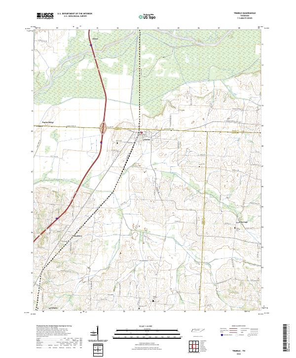
2022 Map of Trimble
USGS Topo · Published 2022About this map
The Obion River and its intricate drainage systems define this West Tennessee landscape, where the Old Obion River Drainage Canal winds through the wetlands north of Trimble. This 2022 survey captures a rural environment structured by its waterways and longstanding agricultural communities. Small family settlements and crossroads like Templeton and Cool Springs are connected by a network of rural routes, including Mason Hall Rd and Sharpes Ferry Rd. Local history is deeply embedded in the land, marked by numerous burial sites such as Pierce Cem and McCorkle Cem, and the quiet waters of Guy Jones Lake. The map illustrates the convergence of three counties—Dyer, Obion, and Gibson—highlighting the complex local boundaries that have shaped the region's development and land management over time.
Find a feature on this map
74 named features on this map. Tap any name to fly to it.
Don’t see what you’re looking for? This feature index may not catch every label — zoom into the map to look around manually.
Map Details
Editions of this 2022 Trimble Map
This is the sole edition of this map. No revisions or reprints were ever made.