2024 Map of Trion
USGS Topo · Published 2024About this map
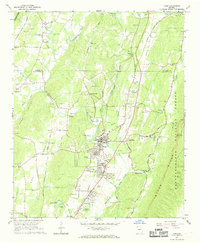
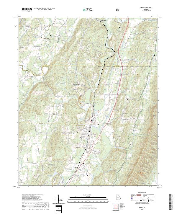
The Chattooga River defines the central corridor of this Northwest Georgia landscape, anchoring the industrial and residential hub of Trion. The town's layout reflects its development along the water, flanked by East Trion and the neighboring settlement of Pennville. The river is fed by numerous tributaries, including Cane Creek, Duck Creek, and Teloga Creek, while smaller bodies of water like Sucker Lake and Lake Wanda Reita dot the valley floor. To the east, the terrain rises into Taylor Ridge, where the map marks the edge of the Chattahoochee National Forest.
Find a feature on this map
162 named features on this map. Tap any name to fly to it.
Don’t see what you’re looking for? This feature index may not catch every label — zoom into the map to look around manually.
Map Details
Editions of this 2024 Trion Map
This is the sole edition of this map. No revisions or reprints were ever made.