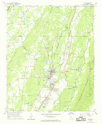
1967 Map of Trion
USGS Topo · Published 1968About this map
The Central of Georgia railroad corridor anchors this mid-century view of Trion, where the river and rail infrastructure supported a growing community near the Chattahoochee National Forest. This mapping era records the landscape just as suburban developments like the Shopping Center and Drive-in Theater began to appear alongside older landmarks like the County Home. The terrain is defined by the prominent Shinbone Ridge and Taylor Ridge, which channel the Chattooga River and its numerous tributaries. For genealogists, the map is particularly dense with rural religious and burial sites, including Trinity Ch, St Peters Chapel Ch, and the Howell Cem. Settlement patterns follow the historical transit routes, visible in the clusters at Welcome Hill and Pennville, while local industry is noted through scattered Gravel Pits and a Claypit.
Find a feature on this map
74 named features on this map. Tap any name to fly to it.
Don’t see what you’re looking for? This feature index may not catch every label — zoom into the map to look around manually.
Map Details
Editions of this 1967 Trion Map
This is the sole edition of this map. No revisions or reprints were ever made.
Other maps of this area

1886 · Ringgold
USGS Topo · 1:125,000

1886 · Rome
USGS Topo · 1:125,000

1892 · Ringgold
USGS Topo · 1:125,000

1898 · Rome
USGS Topo · 1:125,000

1899 · Rome
USGS Topo · 1:125,000

1904 · Rome
USGS Topo · 1:125,000

1935 · Catlett
USGS Topo · 1:24,000

1936 · Estelle
USGS Topo · 1:24,000

1936 · Dougherty Gap
USGS Topo · 1:24,000
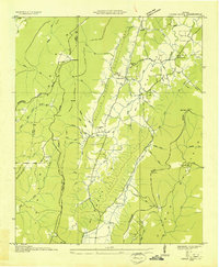
1936 · Cedar Grove
USGS Topo · 1:24,000