
1935 Map of Catlett
USGS Topo · Published 1935About this map
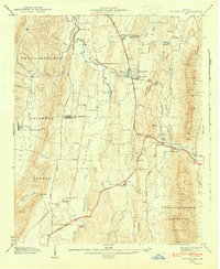
Catlett serves as the central settlement in this mid-1930s depiction of the borderlands between Walker and Whitfield counties. The landscape is defined by the parallel elevations of Peavine Ridge, Taylor Ridge, and Dick Ridge, which dictate the drainage of waterways like Catlett Creek and East Chickamauga Creek. Rural life at this time was organized around small community nodes such as Pine Grove Sch and Henderson Sch, while Gladden Cem provides a specific point of interest for those tracing local family histories. A notable piece of modern infrastructure, a Power Transmission Line, cuts across the southern portion of the sheet, contrasting with the natural feature of Round Pond. The map also captures the early automotive era with the presence of State Highway No 95 winding through the ridge-and-valley terrain.
Find a feature on this map
16 named features on this map. Tap any name to fly to it.
Don’t see what you’re looking for? This feature index may not catch every label — zoom into the map to look around manually.
Map Details
Editions of this 1935 Catlett Map
This is the sole edition of this map. No revisions or reprints were ever made.
Other maps of this area

1886 · Ringgold
USGS Topo · 1:125,000

1892 · Ringgold
USGS Topo · 1:125,000

1935 · Villanow
USGS Topo · 1:24,000

1935 · Nickajack Gap
USGS Topo · 1:24,000

1935 · Tunnel Hill
USGS Topo · 1:24,000

1936 · Kensington
USGS Topo · 1:24,000

1936 · Estelle
USGS Topo · 1:24,000
1943 · Tunnel Hill
USGS Topo · 1:24,000

1946 · Kensington
USGS Topo · 1:24,000
1946 · Nickajack Gap
USGS Topo · 1:24,000