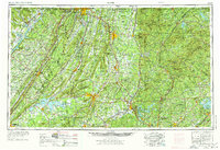
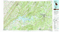
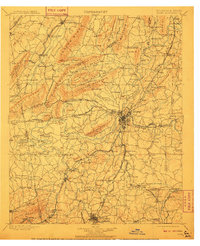
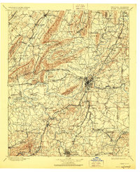
1904 Map of Rome
USGS Topo · Published 1904About this map
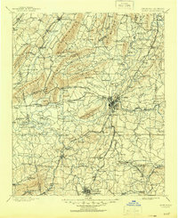
The confluence of the Etowah River and Oostanaula River at Rome forms the Coosa River, a central artery for the region's transport and industry at the turn of the century. This landscape is defined by the parallel ridges of Taylor Ridge, Lavender Mountain, and Horseleg Mountain, which channeled early settlement into fertile stretches like Broomtown Valley and Texas Valley. The survey reveals a sophisticated network of water-based transit, featuring numerous river crossings such as Freeman Ferry, Johnson Ferry, and Bass Ferry, alongside specialized sites like Potash Landing.
Find a feature on this map
159 named features on this map. Tap any name to fly to it.
Don’t see what you’re looking for? This feature index may not catch every label — zoom into the map to look around manually.
Map Details
Editions of this 1904 Rome Map
4 editions found
Historical Maps of Rome Through Time
9 maps found