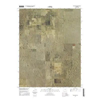
2016 Map of Truckton NE
USGS Topo · Published 2016About this map
The high plains of eastern Colorado are defined by a grid of rural section roads and the winding path of Pond Cr as it crosses the El Paso and Lincoln county line. This 2016 survey captures a landscape primarily dedicated to ranching and aviation, notably featuring the Terra Firma Airport in the northeastern quadrant. Local history is anchored by the Saint Lukes Cem and the Lone Memorial, both situated along Shear Rd. The drainage patterns of the region are reflected in the shifting contours surrounding the creek, while the human footprint is seen in the long, straight reaches of Whittemore Rd and S Rush Rd that connect the remote homesteads of the Truckton area. This mapping illustrates the persistent layout of the Public Land Survey System, which continues to dictate the orientation of property and infrastructure in this semi-arid environment.
Find a feature on this map
24 named features on this map. Tap any name to fly to it.
Don’t see what you’re looking for? This feature index may not catch every label — zoom into the map to look around manually.
Map Details
Editions of this 2016 Truckton NE Map
This is the sole edition of this map. No revisions or reprints were ever made.
Other maps of this area

1889 · Sanborn
USGS Topo · 1:125,000

1891 · Sanborn
USGS Topo · 1:125,000

1893 · Sanborn
USGS Topo · 1:125,000

1893 · Big Springs
USGS Topo · 1:125,000

1954 · Lamar
USGS Topo · 1:250,000

1954 · Pueblo
USGS Topo · 1:250,000

1957 · Pueblo
USGS Topo · 1:250,000

1958 · Pueblo
USGS Topo · 1:250,000

1958 · Lamar
USGS Topo · 1:250,000

1962 · Pueblo
USGS Topo · 1:250,000