2021 Map of Truxton
USGS Topo · Published 2021About this map
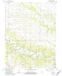
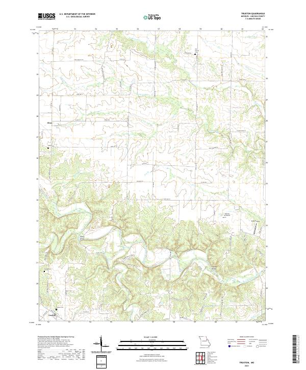
Truxton and Olney anchor this section of Lincoln County, defined by the winding course of the West Fork Cuivre River. The landscape is a network of small creeks and branches, including Big Lead Cr, Little Lead Cr, and Bear Cr, which carve through the terrain near Starkey Hollow. Genealogists will find significant value in the distribution of local burial grounds, such as Old Liberty Cem and Owings Cem, along with named thoroughfares like Patterson School Rd and Duff School Rd that hint at former rural schoolhouse locations.
Find a feature on this map
76 named features on this map. Tap any name to fly to it.
Don’t see what you’re looking for? This feature index may not catch every label — zoom into the map to look around manually.
Map Details
Editions of this 2021 Truxton Map
This is the sole edition of this map. No revisions or reprints were ever made.