Loading...
Loading map...2021 Map of Tsaile
USGS Topo · Published 2021About this map
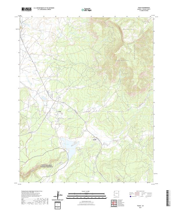
Dine College stands as a central landmark in this high-altitude landscape where the Chuska Mountains and Tuniticha Mountains meet. The settlement of Tsaile is positioned near the shores of Tsaile Lake, a significant water feature fed by Tsaile Cr. This modern survey reveals the spatial relationship between the established community and the northern reaches of Canyon de Chelly National Monument, including the dramatic Canyon del Muerto in the southwest corner.
Find a feature on this map
29 named features on this map. Tap any name to fly to it.
Don’t see what you’re looking for? This feature index may not catch every label — zoom into the map to look around manually.
Map Details
Date Portrayed2021
Date Published2021
PublisherU.S. Geological Survey
Map TypeTopographic
Scale1:24000
Physical Dimensions24 x 29 inches
Editions of this 2021 Tsaile Map
This is the sole edition of this map. No revisions or reprints were ever made.
Historical Maps of Adeií Díwózhii Biiʼ Tó Through Time
Featured Locations
- Apache County, AZ
- Chinle Agency, AZ
- Adeií Díwózhii Biiʼ Tó, Chinle Agency
- Sehili, Chinle Agency
- Tsaile, Chinle Agency
Source Details
SourceU.S. Geological Survey
CopyrightPublic Domain