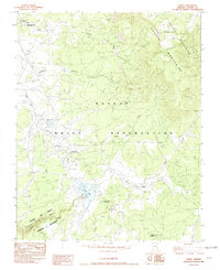
1982 Map of Tsaile
USGS Topo · Published 1982About this map
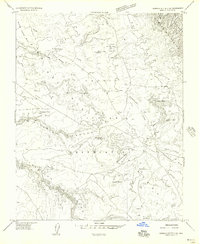
The Navajo Indian Reservation landscape is defined here by the convergence of steep highland terrain and vital water resources in the early 1980s. The Chuska Mountains dominate the eastern portion of the sheet, rising toward Matthews Peak, while the southwestern corner reveals the dramatic topography of Canyon De Chelly National Monument, including the winding Canyon del Muerto. At the heart of this landscape is Tsaile, centered around the Navajo Community College and Tsaile Elementary School. The presence of the Rodeo Arena and South Shore Campground near Tsaile Lake reflects a community organized around institutional education and recreation within the high desert. Further north, the Upper Greasewood Trading Post stands as a traditional landmark of commerce along Greasewood Wash.
Find a feature on this map
25 named features on this map. Tap any name to fly to it.
Don’t see what you’re looking for? This feature index may not catch every label — zoom into the map to look around manually.
Map Details
Editions of this 1982 Tsaile Map
This is the sole edition of this map. No revisions or reprints were ever made.
Other maps of this area

1892 · Canyon De Chelly
USGS Topo · 1:250,000

1954 · Shiprock
USGS Topo · 1:250,000
1955 · Sonsala Butte 1 NW
USGS Topo · 1:24,000

1955 · Sonsala Butte 4 NW
USGS Topo · 1:24,000

1955 · Sonsala Butte 1 SE
USGS Topo · 1:24,000
1955 · Sonsala Butte 1 NE
USGS Topo · 1:24,000

1955 · Sonsala Butte 2 SE
USGS Topo · 1:24,000
1955 · Sonsala Butte 3 NE
USGS Topo · 1:24,000
1955 · Sonsala Butte 2 NE
USGS Topo · 1:24,000

1955 · Sonsala Butte 1 SW
USGS Topo · 1:24,000
Featured Places
- Chinle Agency, AZ
- Sehili, Chinle Agency
- Tsaile, Chinle Agency
- Adeií Díwózhii Biiʼ Tó, Chinle Agency
- Apache County, AZ