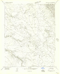
1955 Map of Sonsala Butte 2 NE
USGS Topo · Published 1958About this map
De Chelly Canyon and Tsedatoh Canyon define the complex, eroded landscape of the Defiance Plateau in this mid-century survey of the Navajo Indian Reservation. The map records a sparsely populated region where life centered on seasonal water sources and the high mesas. A network of unimproved roads and trails connects remote landmarks such as Sitting Coyote Mesa and Supai Mesa, while multiple small dams and reservoirs, including Tsedadahotsosi, suggest a managed approach to the area's scarce water resources for grazing or agriculture.
Find a feature on this map
30 named features on this map. Tap any name to fly to it.
Don’t see what you’re looking for? This feature index may not catch every label — zoom into the map to look around manually.
Map Details
Editions of this 1955 Sonsala Butte 2 NE Map
This is the sole edition of this map. No revisions or reprints were ever made.
Other maps of this area

1892 · Canyon De Chelly
USGS Topo · 1:250,000

1953 · Redrock Valley SW
USGS Topo · 1:24,000

1953 · Los Gigantes SE
USGS Topo · 1:24,000

1953 · Los Gigantes SW
USGS Topo · 1:24,000

1953 · Los Gigantes Buttes
USGS Topo · 1:62,500

1953 · Redrock Valley
USGS Topo · 1:62,500

1954 · Shiprock
USGS Topo · 1:250,000
1955 · Sonsala Butte 1 NW
USGS Topo · 1:24,000

1955 · Sonsala Butte 2 SW
USGS Topo · 1:24,000

1955 · Sonsala Butte 2 NW
USGS Topo · 1:24,000