2024 Map of Tumalo
USGS Topo · Published 2024About this map
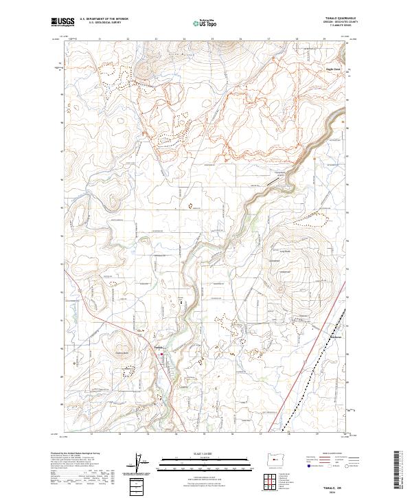
The Deschutes River serves as the primary artery through this high-desert landscape, carving a deep path past the volcanic formations of Cline Buttes and Laidlaw Butte. This modern survey documents the intricate network of water management and recreation that defines the area, showcasing the Tumalo Feed Canal and Swalley Canal as they divert vital water for irrigation. The township of Tumalo remains the central hub, supported by smaller residential pockets and the recreational grounds of Eagle Crest. Local history is anchored at the Tumalo Cem, while the modern utility of the land is highlighted by features like the Flying Alpaca Airport. An extensive trail system, including the Wagon Train Trl and Lariat Loop Trl, crisscrosses the terrain, reflecting the area's contemporary transition from agricultural roots to a destination for outdoor activity.
Find a feature on this map
136 named features on this map. Tap any name to fly to it.
Don’t see what you’re looking for? This feature index may not catch every label — zoom into the map to look around manually.
Map Details
Editions of this 2024 Tumalo Map
This is the sole edition of this map. No revisions or reprints were ever made.
