2022 Map of Turkey
USGS Topo · Published 2022About this map
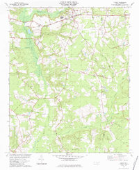
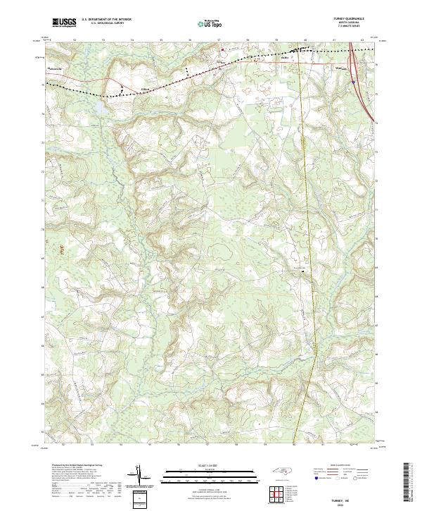
The coastal plain of North Carolina is defined here by the confluence of numerous blackwater branches and runs, where Turkey and Warsaw serve as local hubs near the Sampson and Duplin county line. The landscape is carved by the intricate drainage systems of Six Runs Creek, Carrolls Mill Run, and Sikes Mill Run, suggesting a long history of water-powered industry and agricultural drainage. Smaller settlements like Elliott, Baltic, and Moltonville are connected by a dense network of rural roads that follow the high ground between swampy creek bottoms.
Find a feature on this map
69 named features on this map. Tap any name to fly to it.
Don’t see what you’re looking for? This feature index may not catch every label — zoom into the map to look around manually.
Map Details
Editions of this 2022 Turkey Map
This is the sole edition of this map. No revisions or reprints were ever made.