Loading...
Loading map...2024 Map of Turner
USGS Topo · Published 2024About this map
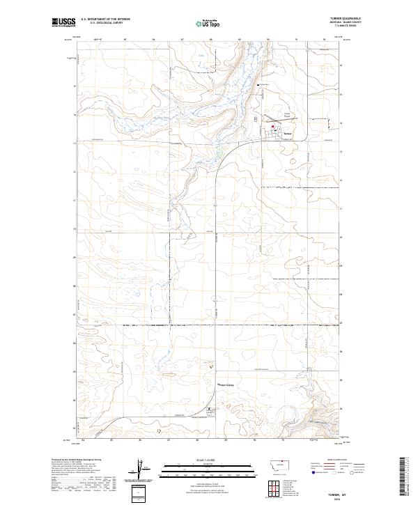
Turner serves as the primary hub in this northern Montana landscape, located near the intersection of Turner Rd and W Railroad Ave. The town is supported by local infrastructure including the Po, the Turner Airport, and the nearby Turner Cemetery. To the south, the Turner Colony represents a distinct communal settlement pattern, complete with its own dedicated Turner Colony Cemetery along Turner Colony Rd.
Find a feature on this map
34 named features on this map. Tap any name to fly to it.
Don’t see what you’re looking for? This feature index may not catch every label — zoom into the map to look around manually.
Map Details
Date Portrayed2024
Date Published2024
PublisherU.S. Geological Survey
Map TypeTopographic
Scale1:24000
Physical Dimensions24 x 29 inches
Editions of this 2024 Turner Map
This is the sole edition of this map. No revisions or reprints were ever made.
Historical Maps of Turner Through Time
Featured Locations
Source Details
SourceU.S. Geological Survey
CopyrightPublic Domain