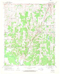
1969 Map of Tushka
USGS Topo · Published 1971About this map
Atoka and the surrounding Choctaw County landscape are defined by the convergence of heavy rail transport and a intricate network of waterways in the late 1960s. The Missouri-Kansas-Texas railroad corridor serves as the primary spine for the region, passing through Tushka and near the smaller settlements of Taloah and Cook. The topography is marked by the wide, low-lying drainage basins of Muddy Boggy Creek and Clear Boggy Creek, which create a complex environment of sloughs and branches, including the Big Slough.
Find a feature on this map
28 named features on this map. Tap any name to fly to it.
Don’t see what you’re looking for? This feature index may not catch every label — zoom into the map to look around manually.
Map Details
Editions of this 1969 Tushka Map
This is the sole edition of this map. No revisions or reprints were ever made.
Other maps of this area

1899 · Atoka
USGS Topo · 1:125,000

1900 · Atoka
USGS Topo · 1:125,000

1956 · Stringtown
USGS Topo · 1:24,000

1957 · Lehigh
USGS Topo · 1:24,000

1957 · Bruno
USGS Topo · 1:24,000

1957 · Ardmore
USGS Topo · 1:250,000

1963 · Ardmore
USGS Topo · 1:250,000
1969 · Boggy Depot
USGS Topo · 1:24,000

1969 · Caddo North
USGS Topo · 1:24,000
1969 · Bentley
USGS Topo · 1:24,000