Loading...
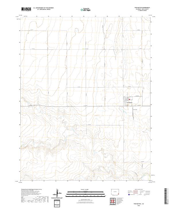
Loading map...2022 Map of Two Buttes
USGS Topo · Published 2022About this map
Two Buttes serves as the primary hub of this eastern Colorado landscape, where a grid of rural routes including Co Rd VV and Co Rd RR provides structure to the high plains. The settlement itself is defined by a traditional street plan featuring Main St, E St, and G St, situated just south of the Railroad 5 corridor.
Find a feature on this map
30 named features on this map. Tap any name to fly to it.
Don’t see what you’re looking for? This feature index may not catch every label — zoom into the map to look around manually.
Map Details
Date Portrayed2022
Date Published2022
PublisherU.S. Geological Survey
Map TypeTopographic
Scale1:24000
Physical Dimensions24 x 29 inches
Editions of this 2022 Two Buttes Map
This is the sole edition of this map. No revisions or reprints were ever made.
Historical Maps of Two Buttes Through Time
Featured Locations
Source Details
SourceU.S. Geological Survey
CopyrightPublic Domain