2023 Map of Unionville
USGS Topo · Published 2023About this map
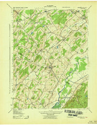
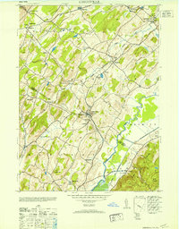
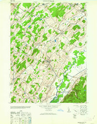
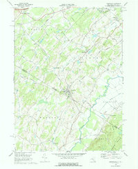
Unionville and Westtown serve as the primary hubs in this corner of the Wallkill Valley, where the New York and New Jersey border divides a landscape defined by traditional agriculture and conservation. The village of Unionville sits just north of the state line, anchored by the Unionville Cem, while further north the Minisink Cem and the settlement of Waterloo Mills suggest a history of localized rural industry. To the east and south, the Wallkill River National Wildlife Refuge preserves a significant corridor of wetlands along the Wallkill River, including the Drumgoole Ditch. The terrain shifts from the low-lying valley floors to the heights of Pochuck Mtn and Kittatinny Mtn, connected by long-standing thoroughfares such as the Minisink Tpke and Greenville Tpke.
Find a feature on this map
141 named features on this map. Tap any name to fly to it.
Don’t see what you’re looking for? This feature index may not catch every label — zoom into the map to look around manually.
Map Details
Editions of this 2023 Unionville Map
This is the sole edition of this map. No revisions or reprints were ever made.
Historical Maps of Warwick Through Time
6 maps found