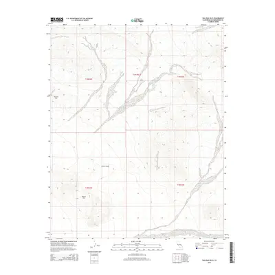
2015 Map of Valjean Hills
USGS Topo · Published 2015About this map
Rabbit Holes Spring serves as a vital water point in this arid stretch of the Mojave Desert within San Bernardino County. The landscape is defined by the prominent Dumont Hills in the northwest and the Valjean Hills to the south, showcasing the intricate topography of the California desert during the early twenty-first century. These elevations and the drainage patterns that wrap around them reflect the harsh environmental conditions that have shaped land use and exploration in the region. The map meticulously documents the township and range boundaries, including t19n r8e and t19n r9e, which provide the legal framework for this remote terrain. This 2015 survey is a record of the enduring geography of the Mojave, where reliable springs like those found here have historically been critical for travelers and local fauna alike.
Find a feature on this map
8 named features on this map. Tap any name to fly to it.
Don’t see what you’re looking for? This feature index may not catch every label — zoom into the map to look around manually.
Map Details
Editions of this 2015 Valjean Hills Map
This is the sole edition of this map. No revisions or reprints were ever made.
Other maps of this area

1910 · Ivanpah
USGS Topo · 1:250,000

1912 · Ivanpah
USGS Topo · 1:250,000

1933 · Avawatz Mountains
USGS Topo · 1:250,000

1942 · Ivanpah
USGS Topo · 1:250,000

1947 · Trona
USGS Topo · 1:250,000

1947 · Kingman
USGS Topo · 1:250,000

1948 · Kingman
USGS Topo · 1:250,000

1948 · Trona
USGS Topo · 1:250,000

1950 · Tecopa
USGS Topo · 1:62,500

1951 · Tecopa
USGS Topo · 1:62,500