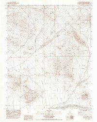
1983 Map of Valjean Hills
USGS Topo · Published 1983About this map
Rabbit Holes Spring serves as a vital water source in this arid corridor of the Mojave Desert, situated between the Dumont Hills and the Kingston Range. This 1983 provisional edition, compiled from aerial photography taken in the late 1970s, documents a landscape defined by extreme relief and complex drainage patterns. The Valjean Hills occupy the central portion of the quadrangle, where the terrain falls away toward the seasonal drainage of Kingston Wash in the southeast. For those studying the historical geography of San Bernardino County, the map provides precise topographic data for this high-desert environment, showing the relationship between isolated springs and the township and range lines of T 19 N and T 18 N that partitioned this public land.
Find a feature on this map
7 named features on this map. Tap any name to fly to it.
Don’t see what you’re looking for? This feature index may not catch every label — zoom into the map to look around manually.
Map Details
Editions of this 1983 Valjean Hills Map
This is the sole edition of this map. No revisions or reprints were ever made.
Other maps of this area

1910 · Ivanpah
USGS Topo · 1:250,000

1912 · Ivanpah
USGS Topo · 1:250,000

1933 · Avawatz Mountains
USGS Topo · 1:250,000

1942 · Ivanpah
USGS Topo · 1:250,000

1947 · Trona
USGS Topo · 1:250,000

1947 · Kingman
USGS Topo · 1:250,000

1948 · Kingman
USGS Topo · 1:250,000

1948 · Trona
USGS Topo · 1:250,000

1950 · Tecopa
USGS Topo · 1:62,500

1951 · Tecopa
USGS Topo · 1:62,500