2023 Map of Valley Grove
USGS Topo · Published 2023About this map
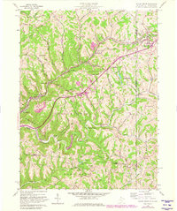
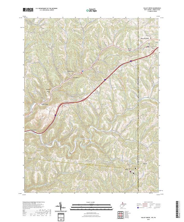
Little Wheeling Creek and Middle Wheeling Creek carve through the dissected plateau of the West Virginia and Pennsylvania borderlands, defining the settlement patterns of Ohio and Washington counties. The region is characterized by small communities and rural outposts that follow the winding valley floors and ridgelines. West Alexander sits at a critical junction near the state line, where the Old Presbyterian Cem and West Alexander Cem provide significant genealogical records for early families in the area. Further south, the village of Dallas serves as a local hub near Dallas Cem, while the northern reaches include the community of Mount Echo. The map documents a landscape where modern transit corridors parallel old routes like National RD, connecting historical points such as Roneys Point, Valley Grove, and Point Mills. This intersection of state boundaries and watercourses like short Creek and Peters Run illustrates the enduring layout of these border townships.
Find a feature on this map
115 named features on this map. Tap any name to fly to it.
Don’t see what you’re looking for? This feature index may not catch every label — zoom into the map to look around manually.
Map Details
Editions of this 2023 Valley Grove Map
This is the sole edition of this map. No revisions or reprints were ever made.
Historical Maps of Mount Echo Through Time
3 maps found