Loading...
Loading map...2021 Map of Valley Springs
USGS Topo · Published 2021About this map
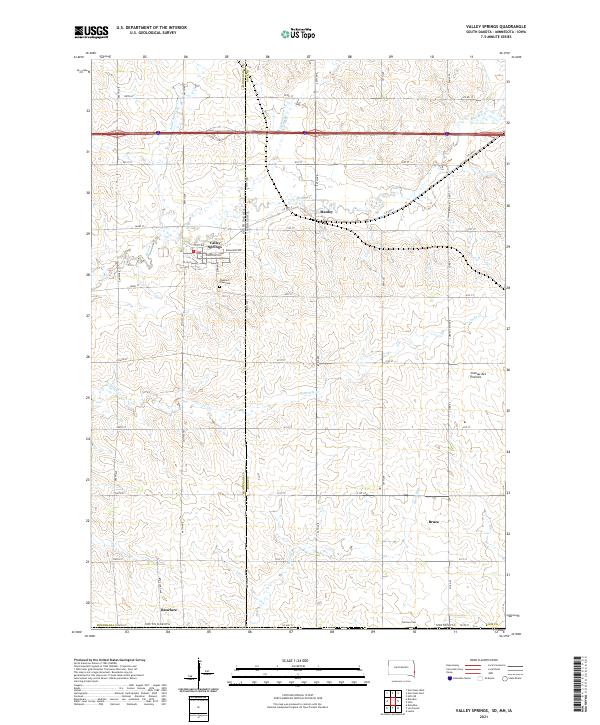
Valley Springs sits at the heart of this landscape where the borders of South Dakota and Minnesota meet, marking the western edge of the Coteau des Prairies upland. This survey captures a region defined by agricultural grid patterns and the drainage of several small waterways, including Beaver Creek and Fourmile Creek. The small settlement of Manley lies just across the state line in Minnesota, while the community of Benclare is situated to the south near the Minnehaha County border.
Find a feature on this map
53 named features on this map. Tap any name to fly to it.
Don’t see what you’re looking for? This feature index may not catch every label — zoom into the map to look around manually.
Map Details
Date Portrayed2021
Date Published2021
PublisherU.S. Geological Survey
Map TypeTopographic
Scale1:24000
Physical Dimensions24 x 29 inches
Editions of this 2021 Valley Springs Map
This is the sole edition of this map. No revisions or reprints were ever made.
Historical Maps of Valley Springs Through Time
Featured Locations
- Valley Springs Township, SD
- Red Rock Township, SD
- Larchwood Township, IA
- Bruce, Martin Township
- Valley Springs, Valley Springs Township
Source Details
SourceU.S. Geological Survey
CopyrightPublic Domain