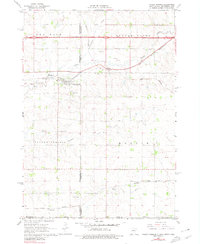
1967 Map of Valley Springs
USGS Topo · Published 1980About this map
Valley Springs and the surrounding tri-state border region are captured here during a period of significant transportation shifts. The town center is defined by the Chicago and North Western railroad corridor and local landmarks like Pleasant View Cem. Just to the north, the massive infrastructure of Interstate 90 cuts across the landscape, paralleling the older Highway 16. This survey reveals the rural character of the Minnehaha and Rock County line, where small settlements like Manley and Benclare sit near the winding paths of Beaver Creek and Springwater Creek. The southern portion of the map transition into the Illinois Central rail line near the community of Bruce. The numerous gravel pits scattered throughout the area suggest a local economy tied to the region's glacial deposits and road construction requirements of the late 1960s.
Find a feature on this map
26 named features on this map. Tap any name to fly to it.
Don’t see what you’re looking for? This feature index may not catch every label — zoom into the map to look around manually.
Map Details
Editions of this 1967 Valley Springs Map
2 editions found
Other maps of this area

1897 · Canton
USGS Topo · 1:125,000

1900 · Canton
USGS Topo · 1:125,000

1955 · Sioux Falls
USGS Topo · 1:250,000

1958 · Sioux Falls
USGS Topo · 1:250,000

1962 · Klondike
USGS Topo · 1:24,000

1962 · Brandon
USGS Topo · 1:24,000

1962 · Garretson West
USGS Topo · 1:24,000

1967 · Valley Springs
USGS Topo · 1:24,000

1967 · Garretson East
USGS Topo · 1:24,000

1967 · Hills
USGS Topo · 1:24,000