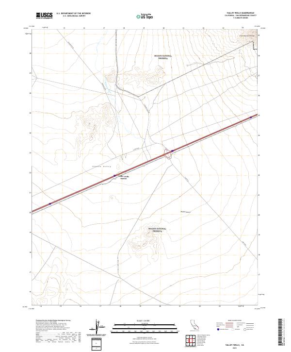
2021 Map of Valley Wells
USGS Topo · Published 2021About this map
The high desert landscape of San Bernardino County is preserved here within the Mojave National Preserve, a territory defined by broad alluvial basins and stark mountain rises. Shadow Valley dominates the central portion of the map, serving as a catchment for seasonal drainage such as Kingston Wash. The map documents a critical transportation corridor where modern infrastructure meets the remnants of older desert tracks. Valley Wells Station sits as a primary point of reference along the main transit artery, while secondary routes like Excelsior Mine Rd and Shadow Mtn Rd lead toward the surrounding heights. To the northeast, the terrain climbs sharply into the Clark Mountain Range, illustrating the typical basin-and-range topography that characterizes this portion of the Mojave Desert.
Find a feature on this map
16 named features on this map. Tap any name to fly to it.
Don’t see what you’re looking for? This feature index may not catch every label — zoom into the map to look around manually.
Map Details
Editions of this 2021 Valley Wells Map
This is the sole edition of this map. No revisions or reprints were ever made.
Other maps of this area

1910 · Ivanpah
USGS Topo · 1:250,000

1912 · Ivanpah
USGS Topo · 1:250,000

1942 · Ivanpah
USGS Topo · 1:250,000

1947 · Kingman
USGS Topo · 1:250,000

1948 · Kingman
USGS Topo · 1:250,000

1954 · Kingman
USGS Topo · 1:250,000

1955 · Kingman
USGS Topo · 1:250,000

1955 · Kingston Peak
USGS Topo · 1:62,500

1955 · Mescal Range
USGS Topo · 1:62,500

1956 · Halloran Spring
USGS Topo · 1:62,500