Loading...
Loading map...2022 Map of Vandemere
USGS Topo · Published 2022About this map
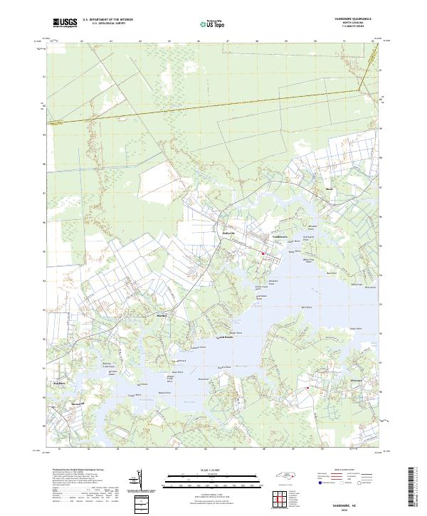
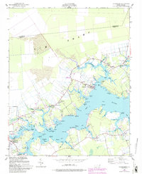
The Bay River defines this coastal landscape where the waters of Vandemere Cr and Smith Cr converge at the historic waterfront of Vandemere. The map reveals a high concentration of named coastal features and points of interest that speak to the region's maritime history, including Graveyard Point, Windmill Point, and the curious Poorhouse Point near Parch Corn Bay.
Find a feature on this map
110 named features on this map. Tap any name to fly to it.
Don’t see what you’re looking for? This feature index may not catch every label — zoom into the map to look around manually.
Map Details
Date Portrayed2022
Date Published2022
PublisherU.S. Geological Survey
Map TypeTopographic
Scale1:24000
Physical Dimensions24 x 29 inches
Editions of this 2022 Vandemere Map
This is the sole edition of this map. No revisions or reprints were ever made.
Historical Maps of Maribel Through Time
Featured Locations
Source Details
SourceU.S. Geological Survey
CopyrightPublic Domain