2024 Map of Varna
USGS Topo · Published 2024About this map
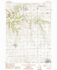
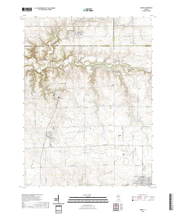
Varna and Magnolia anchor this central Illinois landscape, where the agricultural grid is interrupted by the winding corridors of Sandy Creek and its tributaries. The map reveals a high density of rural cemeteries scattered across the countryside, including Salem Cem, Statler Cem, and First Lutheran Cem Number 2, offering significant value for genealogists tracing family histories in Marshall, Putnam, and LaSalle counties. These burial grounds often align with older transportation routes like Stagecoach Rd and Old Stagecoach Rd, reflecting the early patterns of 19th-century settlement.
Find a feature on this map
55 named features on this map. Tap any name to fly to it.
Don’t see what you’re looking for? This feature index may not catch every label — zoom into the map to look around manually.
Map Details
Editions of this 2024 Varna Map
This is the sole edition of this map. No revisions or reprints were ever made.