Loading...
Loading map...1950 Map of Vega Alta NE
USGS Topo · Published 1950About this map
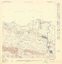
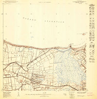
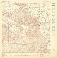
Industrial and agricultural activity centers on the Central Constancia sugar mill near the banks of the Río de la Plata on this mid-century topographic record. The landscape is defined by the logistics of the era, with the American RR threading through the coastal plain, connecting Estación Dorado and Estación Toa Baja. To the west, the Dorado Airfield sits behind the Playa de Sardinera, marking the early transition toward modern transportation infrastructure.
Find a feature on this map
27 named features on this map. Tap any name to fly to it.
Don’t see what you’re looking for? This feature index may not catch every label — zoom into the map to look around manually.
Map Details
Date Portrayed1950
Date Published1950
PublisherU.S. Geological Survey
Map TypeTopographic
Scale1:10000
Physical Dimensions30.65 x 31.67 inches
Editions of this 1950 Vega Alta NE Map
This is the sole edition of this map. No revisions or reprints were ever made.
Historical Maps of Parcelas San Antonio Through Time
3 maps found
Featured Locations
- Toa Baja, Toa Baja
- La Aldea, Dorado
- Dorado, Dorado
- Parcelas San Antonio, Dorado
- Sector Sardinera, Dorado
Source Details
SourceU.S. Geological Survey
CopyrightPublic Domain