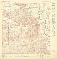
1950 Map of Vega Alta SE
USGS Topo · Published 1950About this map
The hills and valleys of Maguayo and Espinosa dominate this mid-century view of northern Puerto Rico, where the interior terrain transitions into the coastal plains. The map illustrates a landscape of established rural settlements like Monterrey and Santa Rosa connected by a network of winding roads and a prominent LíNea De TransmisióN. Religious life in the area is anchored by the Iglesia del Sagrado Corazón and Iglesia del Cristo situated near the municipal borders.
Find a feature on this map
24 named features on this map. Tap any name to fly to it.
Don’t see what you’re looking for? This feature index may not catch every label — zoom into the map to look around manually.
Map Details
Editions of this 1950 Vega Alta SE Map
This is the sole edition of this map. No revisions or reprints were ever made.
Other maps of this area

1940 · Vega Alta
USGS Topo · 1:30,000

1941 · Bayamon
USGS Topo · 1:30,000

1946 · Corozal
USGS Topo · 1:30,000

1946 · Vega Alta
USGS Topo · 1:30,000

1946 · Naranjito
USGS Topo · 1:30,000

1947 · Corozal NO
USGS Topo · 1:10,000
1947 · Corozal NE
USGS Topo · 1:10,000

1947 · Bayamon
USGS Topo · 1:30,000
1947 · Naranjito NO
USGS Topo · 1:10,000
1947 · Vega Alta SO
USGS Topo · 1:10,000
Featured Places
- Sector Arenas, Vega Alta
- Monte Rey, Vega Alta
- Haciendas del Dorado, Dorado
- Kuilan, Dorado
- Villa Iriarte, Dorado