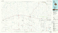
1985 Map of Vega
USGS Topo · Published 1989About this map
Vega stands at a central junction on this mid-1980s planimetric survey of the Texas Panhandle, where the high plains break into the drainage systems of the Canadian River. This period shows the region's established ranching and agricultural grid, with the Burlington Northern line serving the grain-elevator settlements of Adrian, Landergin, and Wildorado. The landscape is defined by its water sources, including Randall Lake and Red Windmill Lake, which supported livestock across the vast reaches of Oldham and Deaf Smith counties.
Find a feature on this map
67 named features on this map. Tap any name to fly to it.
Don’t see what you’re looking for? This feature index may not catch every label — zoom into the map to look around manually.
Map Details
Editions of this 1985 Vega Map
2 editions found
Other maps of this area

1934 · Ady
USGS Topo · 1:62,500

1934 · Cliffside
USGS Topo · 1:62,500

1936 · Fourways
USGS Topo · 1:62,500

1936 · Cliffside
USGS Topo · 1:62,500

1936 · Ady
USGS Topo · 1:62,500

1953 · Marsh
USGS Topo · 1:24,000

1953 · Puente
USGS Topo · 1:24,000

1953 · Cliffside
USGS Topo · 1:24,000

1954 · Tucumcari
USGS Topo · 1:250,000

1954 · Amarillo
USGS Topo · 1:250,000