2022 Map of Versailles
USGS Topo · Published 2022About this map
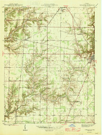
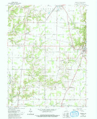
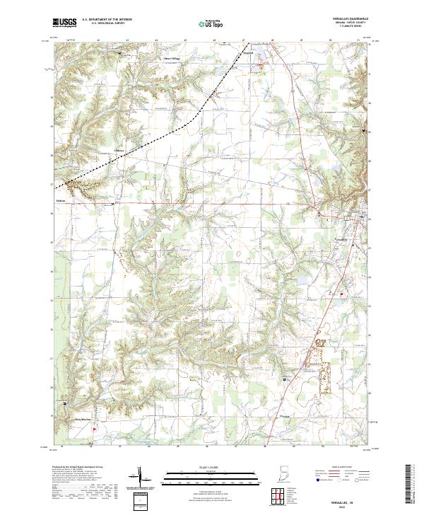
The Ripley County Courthouse stands as a central landmark in Versailles, anchoring a landscape defined by the deep incisions of Graham Creek and its many tributaries. This portion of southeastern Indiana shows a dense network of country roads, such as Old Michigan Rd, connecting a series of small, established settlements including Osgood, Holton, and Dabney. The terrain is notably fractured by drainage systems like Coon Hollow and Hungry Hollow, where the land drops away from the flat agricultural uplands into wooded creek bottoms. Evidence of early settlement patterns and family history is preserved through several scattered burial grounds, including Holman Cem, Bradshaw Cem, and Sheppard Cem. Transportation corridors are prominent, with the W Railroad Rd following the rail line through the northern part of the quadrangle, linking the community of Osgood to the surrounding rural landscape.
Find a feature on this map
99 named features on this map. Tap any name to fly to it.
Don’t see what you’re looking for? This feature index may not catch every label — zoom into the map to look around manually.
Map Details
Editions of this 2022 Versailles Map
This is the sole edition of this map. No revisions or reprints were ever made.
Historical Maps of Dabney Through Time
3 maps found