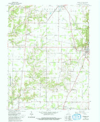
1961 Map of Versailles
USGS Topo · Published 1994About this map
Versailles State Park anchors the eastern edge of this Ripley County landscape, where the town of Versailles serves as the local seat. The area is defined by a traditional Midwestern rural layout, punctuated by the industrial presence of the Baltimore and Ohio Railroad and the massive footprint of the Jefferson Proving Ground in the southwest. This military facility, alongside small rural hubs like Osgood and Dabney, illustrates the diverse land use of the mid-20th century, from government defense testing to agriculture and conservation.
Find a feature on this map
40 named features on this map. Tap any name to fly to it.
Don’t see what you’re looking for? This feature index may not catch every label — zoom into the map to look around manually.
Map Details
Editions of this 1961 Versailles Map
2 editions found
Other maps of this area

1946 · Versailles
USGS Topo · 1:24,000

1946 · Milan
USGS Topo · 1:24,000

1946 · Pierceville
USGS Topo · 1:24,000

1946 · Osgood
USGS Topo · 1:24,000

1953 · Cincinnati
USGS Topo · 1:250,000

1956 · Louisville
USGS Topo · 1:250,000

1957 · Cincinnati
USGS Topo · 1:250,000

1958 · Millhousen
USGS Topo · 1:24,000

1959 · Holton
USGS Topo · 1:24,000

1959 · San Jacinto
USGS Topo · 1:24,000