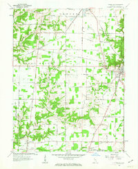
1961 Map of Versailles
USGS Topo · Published 1963About this map
The Baltimore and Ohio Railroad cuts across this Ripley County landscape, connecting the town of Osgood with the crossing at Dabney. To the east, the seat of Versailles is bordered by the expansive Versailles State Park, while the western edge of the map is defined by the sharp boundary of the US Military Reservation Jefferson Proving Ground. This contrast between preserved recreation land, active military territory, and agricultural townships illustrates the varied land use in early 1960s Indiana. Rural life is anchored by locations such as Tanglewood Ch, Correct, and New Marion, with numerous family and community burial grounds like Holman Cem and Otter Village Cem providing significant touchstones for genealogical research. The map also captures mid-century social markers, including a Drive-in Theater and Roadside Park along the highway corridors.
Find a feature on this map
42 named features on this map. Tap any name to fly to it.
Don’t see what you’re looking for? This feature index may not catch every label — zoom into the map to look around manually.
Map Details
Editions of this 1961 Versailles Map
2 editions found
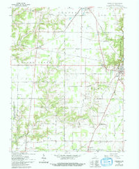
Other maps of this area

1946 · Versailles
USGS Topo · 1:24,000

1946 · Milan
USGS Topo · 1:24,000

1946 · Pierceville
USGS Topo · 1:24,000

1946 · Osgood
USGS Topo · 1:24,000

1953 · Cincinnati
USGS Topo · 1:250,000

1956 · Louisville
USGS Topo · 1:250,000

1957 · Cincinnati
USGS Topo · 1:250,000

1958 · Millhousen
USGS Topo · 1:24,000

1959 · Holton
USGS Topo · 1:24,000

1959 · San Jacinto
USGS Topo · 1:24,000